Dogs at the Bridge
Posted on May 17,2019Article Date Jun 01, 2001
By Capt Thomas H. Presecan
Situation
 The Caribbean island of St. Karen is characterized by steep hills, cliffs, and swollen rivers. The soil is rocky with low-growing shrubs in the southern and midland regions, with forests in the northern and eastern regions. Two years ago, the emperor of St. Karen declared his nation a “druggie safe state.” It is now a haven for drug smugglers. Three large cartels have joined forces and are known as the Greyson Dogs. They fund impressive land and naval forces. Their terrorist activities in the region include piracy, raids on neighboring islands, and attacks on U.S. Coast Guard patrols. Regimental Landing Team 6 has successfully pushed the “Dogs” into the northern forest regions and is now staged in assembly areas, preparing to continue offensive operations.
You are a combat engineer squad leader. Your platoon is attached to Battalion Landing Team 1/6. Your platoon commander issues you the following order:
The battalion is getting ready to push out across the Penny River tomorrow afternoon. We want to go across in the western part of the forest where the Dogs don’t expect us. There’s a bridge located on Route 610. Your mission is to conduct an engineer route reconnaissance along Route 610 up to and including the Penny River Bridge in order to confirm the battalion’s route for the attack. Don’t be compromised-the battalion commander doesn’t want to tip his hand. Good luck.
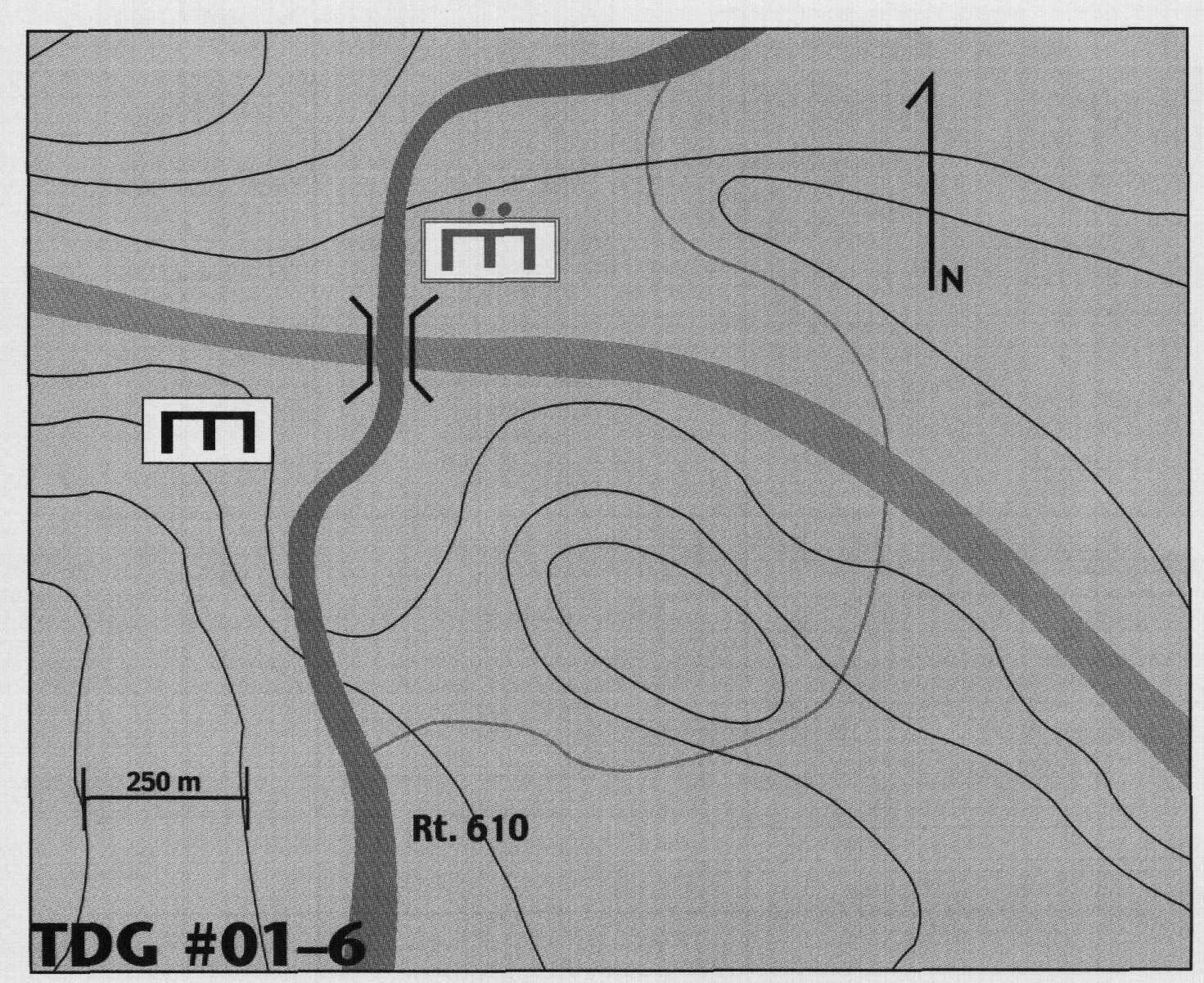
Your nine-man squad is organized into Demo Teams I and 2. You have one M203 with M16, one M249 squad automatic weapon, seven M16s, a PRC-119, and two sets of ANPVS-7 night vision goggles. You set out just before sunset. The patrol to the bridge is uneventful, and you find the road to be in good shape. Arriving at the bridge in darkness, you take up a position to overlook the area as depicted on the map. You immediately notice five to six individuals working busily to prepare the bridge span for demolition. You note that the water appears to be deep and moving at about 3 feet per second. The banks are steep on both sides, but the bridge is made of concrete and appears sturdy. You see a fork in the road that travels off to the east to a possible ford site. It looks rugged. The banks are steep and rutted, and who knows what the streambed looks like. You figure a few hours work with bulldozers and dump trucks might make it operational.
You call back to battalion and explain the situation. You are not sure they understood your transmission. Their reply is broken: “Rogshh … If … across… dord … <click>worried .. tion … <zzzhzhz> … can’t let thrick … mission … shshs….”
As the Dog engineers put the final charges in place, you can see firing wire is being stretched from a position of defilade to the bridge. What now?
Requirement
In a time limit of 5 minutes, issue your orders to your team leaders. Provide a brief rationale for your actions and a sketch of your plan. Submit your solution to Marine Corps Gazette, TDG #01-6, P.O. Box 1775, Quantico, VA 22134, fax 703-630-9147, or email <gazette@mca-marines.org>.
For more detailed information on the structure of Marine Corps units, Marine Corps equipment, and symbols used in TDG sketches, see MCG, Oct94, pp. 53-56 and the modification reported in Jan95, p. 5.


